Tahoe’s Quintessential Hike – Tahoe Rim Trail
See our Best Trails guide, including World’s Best Hikes: 20 Epic Trails.
Situated at 6,225 feet (1,897 meters) above sea level, California’s Lake Tahoe is the largest alpine lake in North America. While Lake Tahoe has always provided boundless recreation opportunities, only recently has it been possible to circumnavigate the crest of the lake on a single trail.
Proposed by Glenn Hampton, a recreation officer at the U.S. Forest Service Tahoe Basin Unit, the 165-mile (266 kilometer) Tahoe Rim Trail (TRT) was constructed by an almost entirely volunteer effort and completed in 2001. The TRT has eight trailheads that split the trail into sections ranging from 13 to 31 miles (21 to 50 kilometers). Besides the pure length of each segment, what makes the trail especially challenging and appealing is that these sections can include up to 3,000-foot (915-meter) climbs and drops—and some of the most spectacular views of Lake Tahoe.
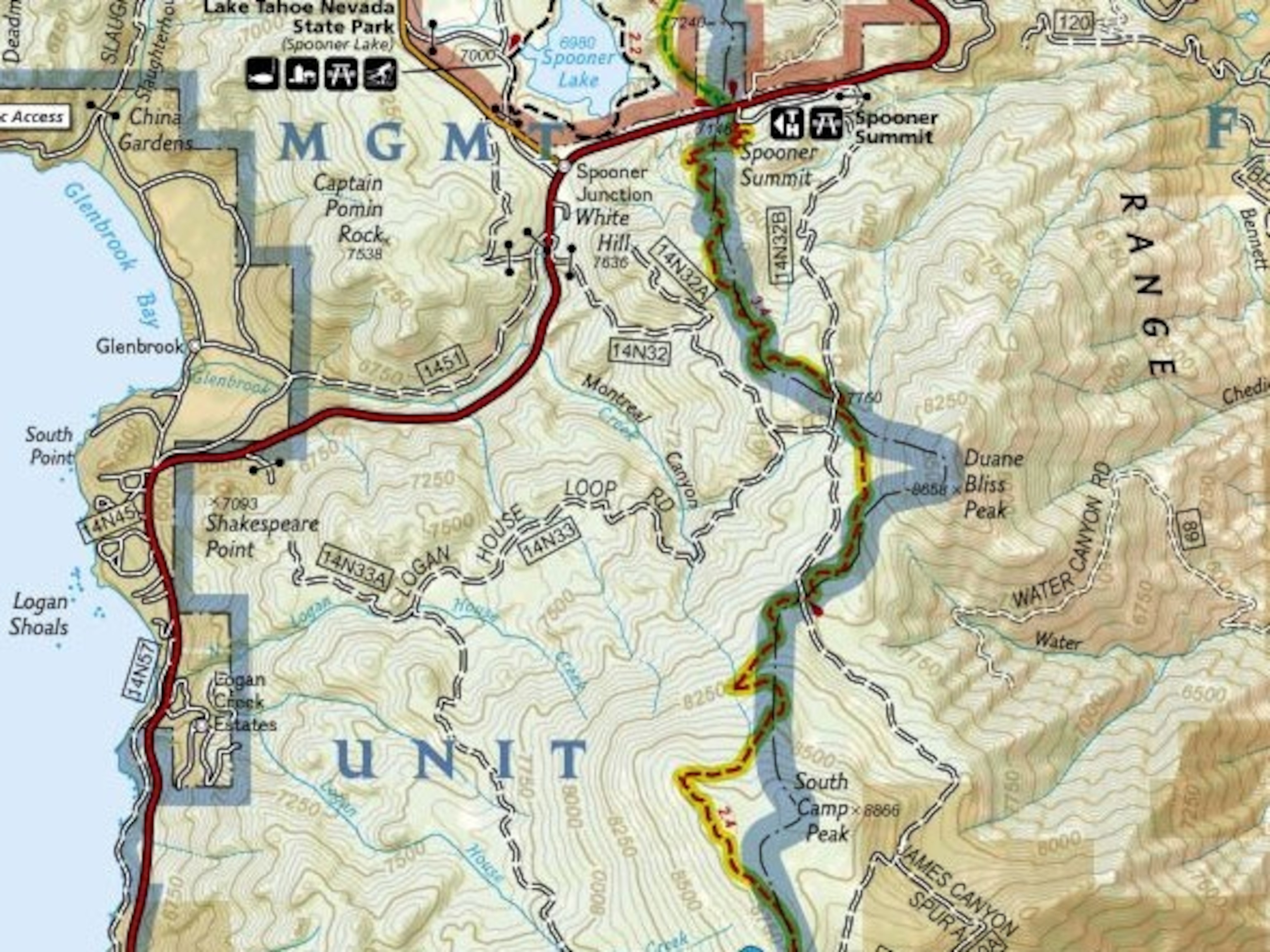
We highly recommend carving out two weeks to through hike the full TRT, but if you can’t escape for that long, you can still enjoy some of the challenge and splendor by hiking the 12.2-mile (16.6-kilometer) segment from Spooner Summit to Kingsbury Grade North. Following the peaks of the Carson Range, this section of the TRT weaves through huge trunks of ancient firs, granite outcrops, and an endless number of panoramic outlooks over Lake Tahoe.
About AllTrails: Find information, maps, photos, and reviews on over 40,000 trails across the U.S. & Canada at AllTrails.com. Join AllTrails Pro to instantly access National Geographic TOPO! and Trails Illustrated Maps to plan your next adventure. Learn more here.
Related Topics
Go Further
Animals
- This ‘saber-toothed’ salmon wasn’t quite what we thoughtThis ‘saber-toothed’ salmon wasn’t quite what we thought
- Why this rhino-zebra friendship makes perfect senseWhy this rhino-zebra friendship makes perfect sense
- When did bioluminescence evolve? It’s older than we thought.When did bioluminescence evolve? It’s older than we thought.
- Soy, skim … spider. Are any of these technically milk?Soy, skim … spider. Are any of these technically milk?
- This pristine piece of the Amazon shows nature’s resilienceThis pristine piece of the Amazon shows nature’s resilience
Environment
- Are the Great Lakes the key to solving America’s emissions conundrum?Are the Great Lakes the key to solving America’s emissions conundrum?
- The world’s historic sites face climate change. Can Petra lead the way?The world’s historic sites face climate change. Can Petra lead the way?
- This pristine piece of the Amazon shows nature’s resilienceThis pristine piece of the Amazon shows nature’s resilience
- Listen to 30 years of climate change transformed into haunting musicListen to 30 years of climate change transformed into haunting music
History & Culture
- Meet the original members of the tortured poets departmentMeet the original members of the tortured poets department
- Séances at the White House? Why these first ladies turned to the occultSéances at the White House? Why these first ladies turned to the occult
- Gambling is everywhere now. When is that a problem?Gambling is everywhere now. When is that a problem?
- Beauty is pain—at least it was in 17th-century SpainBeauty is pain—at least it was in 17th-century Spain
Science
- Here's how astronomers found one of the rarest phenomenons in spaceHere's how astronomers found one of the rarest phenomenons in space
- Not an extrovert or introvert? There’s a word for that.Not an extrovert or introvert? There’s a word for that.
- NASA has a plan to clean up space junk—but is going green enough?NASA has a plan to clean up space junk—but is going green enough?
- Soy, skim … spider. Are any of these technically milk?Soy, skim … spider. Are any of these technically milk?
Travel
- Could Mexico's Chepe Express be the ultimate slow rail adventure?Could Mexico's Chepe Express be the ultimate slow rail adventure?
- What it's like to hike the Camino del Mayab in MexicoWhat it's like to hike the Camino del Mayab in Mexico